CUT BENCH MARK
-
jim
- Posts: 1898
- Joined: Sun 17 May, 2009 10:09 am
Re: CUT BENCH MARK
Interesting choice of equipment - plane table, binoculars, cloth tape. Brings back memories of surveying class at school.
-
liits

- Posts: 1153
- Joined: Sun 25 Mar, 2007 11:24 am
- Location: North London
- Contact:
Re: CUT BENCH MARK
I'd not noticed that he's not using a theodolite.
I've seen a BTC film about surveyors re-aligning a length of track and using a theodolite and trainee surveyors using a plane table and I couldn't work out what they were doing!
I've seen a BTC film about surveyors re-aligning a length of track and using a theodolite and trainee surveyors using a plane table and I couldn't work out what they were doing!
-
jim
- Posts: 1898
- Joined: Sun 17 May, 2009 10:09 am
Re: CUT BENCH MARK
A plane table allows you to identify a number of positions at the same elevation and to calculate the included angles from the viewing position. By selecting the most apropriate point on a sheet of paper mounted on the table and by drawing lines from that point using the sighting bar (alidade) it is possible, provided the distances to the objects have been measured, to work out the distances between them. I think I have got that right, but it was in 1956/7 (in Lincoln) that I was shown how to use one, and my memories are hazy. I recall surveying the abbey ruins not far from the school one day. The Master in charge was not much of a disciplinarian, and we spent our time walking to the surveying sites with different groups carrying bits of equipment by different routes and managing to lose each other.
-
buffaloskinner

- Posts: 1448
- Joined: Sun 01 Apr, 2007 6:02 pm
- Location: Nova Scotia
Re: CUT BENCH MARK
Talking of benchmarks; my cousin in Ohio is a Geodesist, he works for the National Oceanic and Atmospheric Administration (NOAA) based at Ohio State University and spends a lot of his time working in the field.
The NOAA is the equivalent of our Ordnance Survey (so he informs me) and his job description as a Geodesist includes him doing the following:
1. Studing size, shape, and the gravitational field of earth: Employing surveying and geodetic instruments, such as transits, theodolites, and other engineering instruments, in setting up and improving network of triangulation over earth's surface, in order to provide fixed points for use in making maps.
2. Establishing bench marks.
3. Performing gravimetric surveying to determine variations in earth's gravitational field, and provides data used in determination of weight, size, and mass of earth.
His work involves looking after the beautiful area of the Great Lakes, but means a lot of time away from home.
However I am not sure if the American bench marks are the same as ours, but would think that they are.
Is this the end of the story ...or the beginning of a legend?
-
Brunel

- Posts: 1182
- Joined: Thu 20 Mar, 2008 12:34 pm
-
Brunel
- Posts: 1182
- Joined: Thu 20 Mar, 2008 12:34 pm
-
Leodian

- Posts: 6519
- Joined: Thu 10 Jun, 2010 8:03 am
Re: CUT BENCH MARK
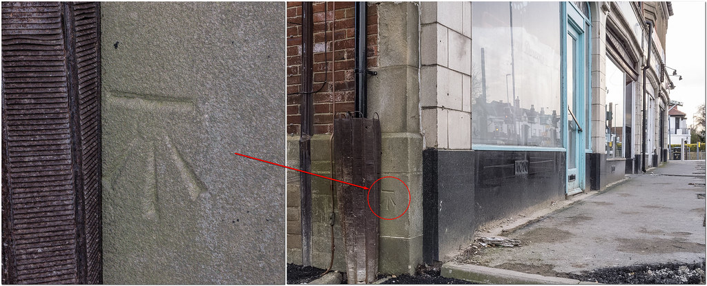
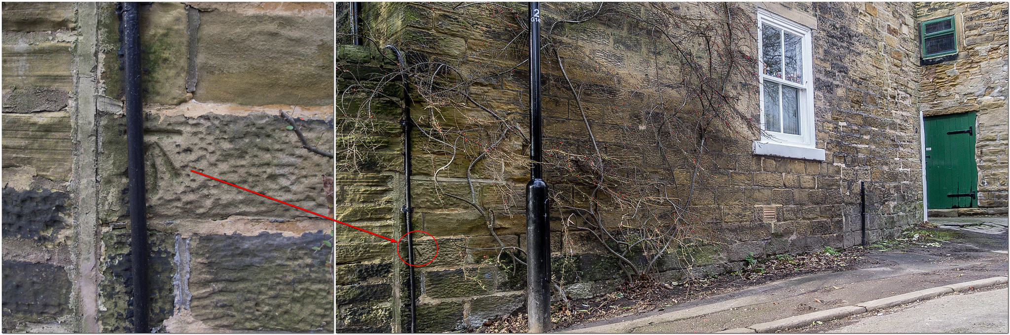
I was only casually looking at brickwork as I walked by on February 11 2016 so I was surprised that I spotted this BM. It is on Bishopgate Street close to where that meets Neville Street. I have however been unable to definitely find if the BM is marked on old maps due to my confusion that it may or may not be a BM that may or may not be marked on New Station Street! The BM does however seem to be marked on a 1953/54 1:1250 map in the Old Maps UK (OMUK) website as 'BM 100.87' and on a 1961/69 1:1250 map as what seems to read 'BM 100.81' (the figures are height in feet, above sea level). I suspect the BM is older and would be grateful if anyone can give an earlier year that it was there.
The first photo is a close-up of the BM and the second shows its location in the large stones just above street level left and down of the post and the traffic lights.
The first photo is a close-up of the BM and the second shows its location in the large stones just above street level left and down of the post and the traffic lights.
- Close up of the Bench Mark (taken Feb 11 2016).
- 727R.jpg (128.54 KiB) Viewed 10129 times
- Location of the Bench Mark (taken Feb 11 2016).
- 728R.jpg (117.1 KiB) Viewed 10129 times
A rainbow is a ribbon that Nature puts on when she washes her hair.
-
buffaloskinner
- Posts: 1448
- Joined: Sun 01 Apr, 2007 6:02 pm
- Location: Nova Scotia
Re: CUT BENCH MARK
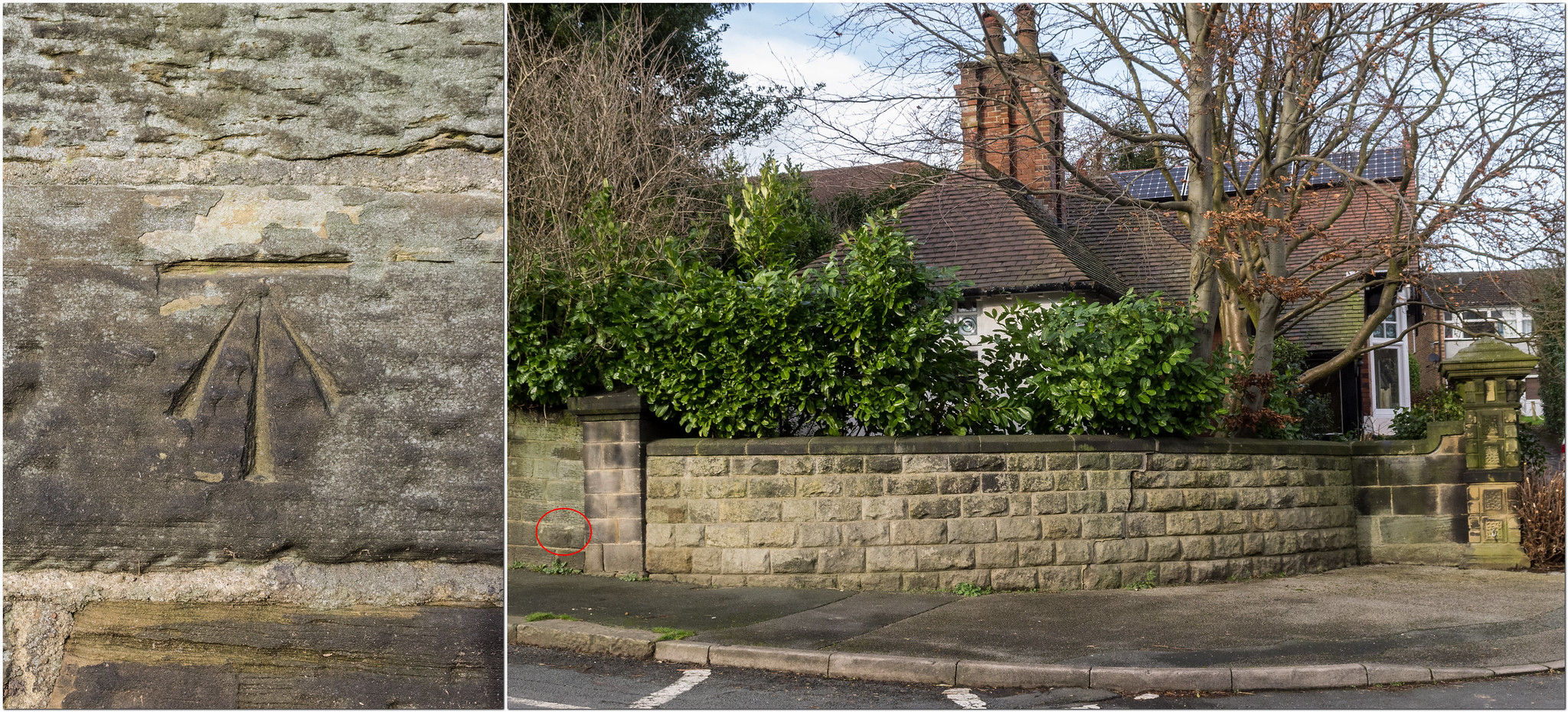
1910 map of Bishopgate Street shows it quite clearly

- Attachments
-
- Bishopgate St 1910.JPG (165.33 KiB) Viewed 10125 times
-
- Bishopgate St 1910 BM.JPG (42.16 KiB) Viewed 10125 times
Is this the end of the story ...or the beginning of a legend?
-
Leodian
- Posts: 6519
- Joined: Thu 10 Jun, 2010 8:03 am
Re: CUT BENCH MARK
Thanks buffaloskinner for the 1910 map (and the enlargement) of Bishopgate Street  . I really must subscribe to such as Old Maps UK, or similar, to get better reproductions.
It's interesting that at 101.33 the BM height above sea level recorded also differs from the 100.81 and 100.87 on the two maps that I noted did recorded the BM. It would seem that the height of a BM may be resurveyed at times but if so I wonder how often?
On the 1910 map some abbreviations are recorded. I assume that MH is Man Hole, FH is Fire Hydrant and LP is Lamp Post. I wonder though what ES (or E8?) stands for?
A rainbow is a ribbon that Nature puts on when she washes her hair.
-
Brunel
- Posts: 1182
- Joined: Thu 20 Mar, 2008 12:34 pm