Page 2 of 3
Re: Benyons Court
Posted: Tue 10 Nov, 2015 12:06 am
by buffaloskinner
On the 1891 map there are two Corn Mills at the end of Manor Road, the People's Mill and Camp Field Mill both of which state they worked with corn in some way.

Re: Benyons Court
Posted: Tue 10 Nov, 2015 10:22 am
by tyke bhoy
Well I said I could be proved wrong. I'm somewhat amazed that food would be processed in such a sooty smoggy environment. I suppose the one upside is that it was to the west of the industrialised area and therefore the prevailing westerly winds would normally blow the pollution away.
The two mills would occupy roughtly the same space as the white roofed buildings here
https://goo.gl/maps/E91DJoS2fsn between Marshall and David Streets
Re: Benyons Court
Posted: Tue 10 Nov, 2015 10:29 am
by rikj
No help in locating Benyon Court, but on the 1852 OS map Benyon Beck is still extant. Looks to outfall into the Aire just downstream from Victoria Bridge.
Makes me wonder who Benyon was to have a beck named after him? Or is there another explanation?
Re: Benyons Court
Posted: Tue 10 Nov, 2015 7:39 pm
by Leodian
rikj wrote:No help in locating Benyon Court, but on the 1852 OS map Benyon Beck is still extant. Looks to outfall into the Aire just downstream from Victoria Bridge.
Makes me wonder who Benyon was to have a beck named after him? Or is there another explanation?
Cheers rikj for the mention about Benyon Beck, as I don't recall knowing of that before.
I have attached a section of a map I've copied from the National Library of Scotland website of the 'OS Six-inch. Yorkshire 218 (includes: Leeds; Rothwell). Surveyed: 1846 to 1847. Published: 1852' map. It is enlarged a lot to show the beck, so I hope it is still readable. Benyon Beck meanders around about across the centre of the image. It seems to start from Low Beck (which seems here to become Hol Beck) and runs to seemingly join the River Aire near Victoria Bridge (it seems unlikely that it will have started there and run right to left to Low Beck). I wonder what traces (if any) remain of Benyon Beck?
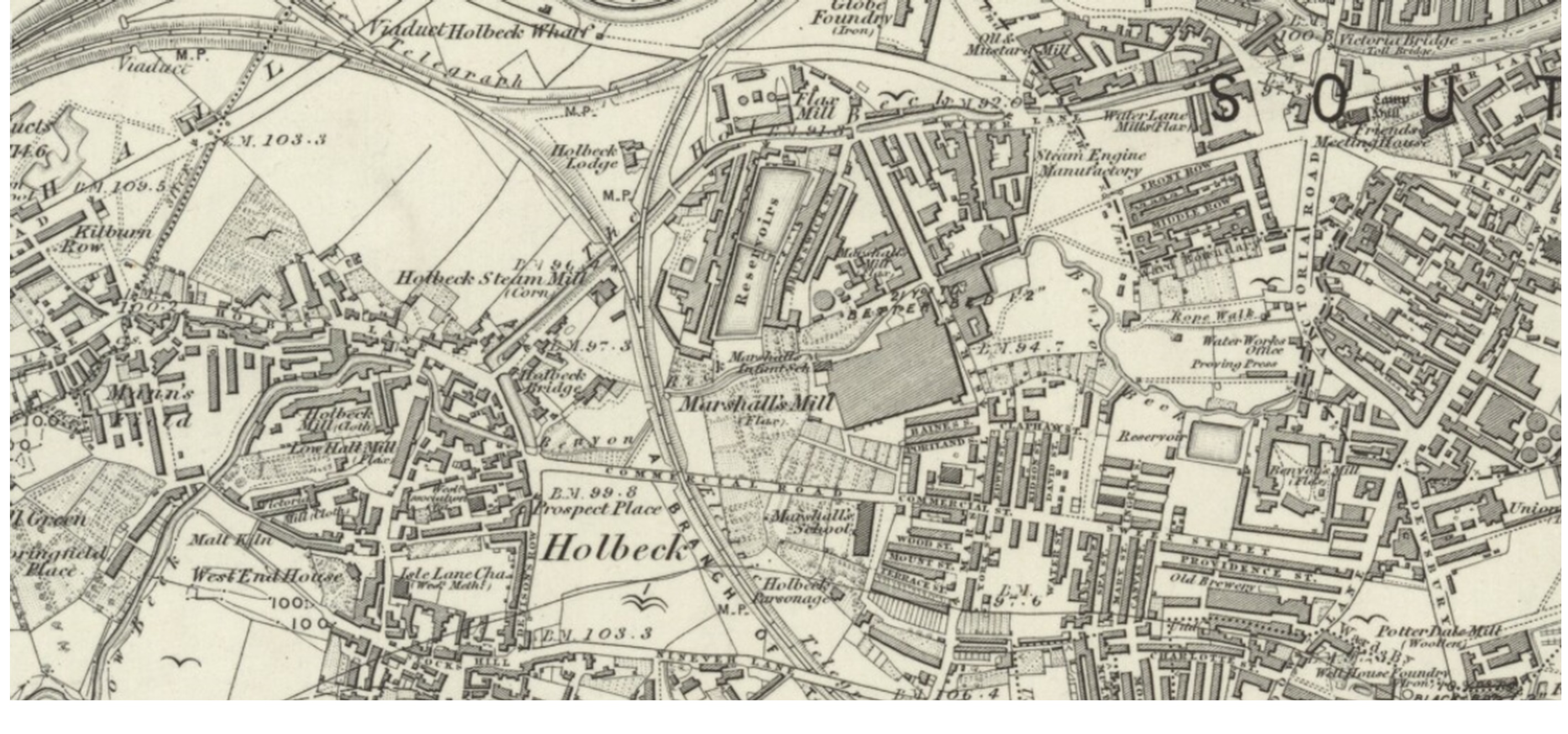
- NLS1846To1847.jpg (950 KiB) Viewed 75435 times
Re: Benyons Court
Posted: Tue 10 Nov, 2015 8:08 pm
by jim
If I remember correctly, the Benyon Beck outfall was just to the west of Leeds Bridge, and the small arch is still to be seen.
Re: Benyons Court
Posted: Wed 11 Nov, 2015 8:22 am
by The Parksider
Brilliant Map Uncle Mick! Is this an online resource?
How far did they map? just the urban areas??
Re: Benyons Court
Posted: Wed 11 Nov, 2015 9:05 am
by uncle mick
Mostly the central areas Parksider. They are listed in no particular order but they are "zoomable" & very detailed & yes an online resource
List here
http://www.bl.uk/search/og/search?q=lee ... _yorkshire
Re: Benyons Court
Posted: Fri 21 Jul, 2023 8:47 pm
by MiggyBill
It's been a long while since this thread was last used but I thought I might as well add something.
On the 1850s OS map of Leeds it shows a "Kenyon's Court" as highlighted in my attached map. I wouldn't mind betting this is a spelling error, I have found other spelling errors on OS maps in the past. Also as Chemimike pointed out, there are 5 dwellings in Benyon Court, 1-4 are joine with no. 5 seperate. This description fits "Kenyon's Court" on the map. What do you think?
Re: Benyons Court
Posted: Sat 22 Jul, 2023 12:41 pm
by chemimike
I think you are correct. A mistake on the OS's part. This is from White's 1875 directory
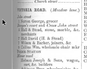
- ScreenHunter 6753.jpg (42.53 KiB) Viewed 66401 times
Re: Benyons Court
Posted: Sat 22 Jul, 2023 3:41 pm
by MiggyBill
Here is the best photo I can find, courtesy of Leodis.
Benyon's Ct would be where the gap is as shown.