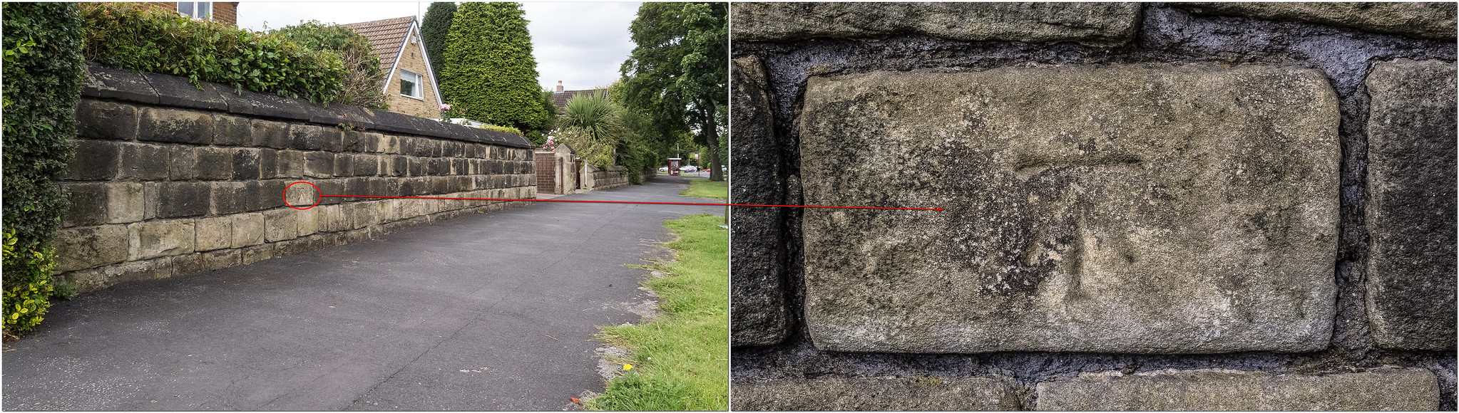
chameleon wrote:Many church spires and towers were frequently ustilised as triangulation points ( largely superseded by GPS of course), those used for this are noted on OS maps and all have a bench mark at ground level.
A good example of a church tower used as a triangulation point and indicated with a BM [whcih was not used as a leveling line BM] and which also has a BM is St John's Church, Briggate.
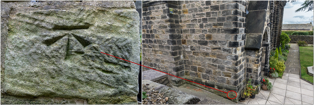
The tower has a flush bracket plate for the leveling - this is the only flush bracket I've found in Leeds while the trig is indicated by a cut benchmark in the boundary wall on Briggate. The BM is beside and below the blue plaque and I've tried to photograph it twice but its proximity to the bus stop means that it always seems to have somebody leaning against it!
Hi liits .
I posted a photo on March 29 2012 of the BM on the wall of St. Johns on New Briggate and on February 26 2013 you added a good photo of the Flush Bracket on the church. I recall it took me some while to be able to take a photo of the BM without people sitting in front of it! This is the link to the thread:- http://secretleeds.com/viewtopic.php?t=3830
A rainbow is a ribbon that Nature puts on when she washes her hair.